In the battle for world opinion with respect to the war in Ukraine, most now decry Russia for its initial invasion and for its subsequent behaviour. And satellite imagery has been key to this. NATO is providing everything it can to Ukraine short of actual military engagement – including satellite intelligence.
However, military satellite operators are loath to publicise their imagery lest it gives potential adversaries information, both from images themselves or in terms of ground resolution capabilities. Commercial satellite operators, whose capabilities have been closing in on government satellite systems in recent years, have risen up to the role. One of the main suppliers of intel is Maxar Technologies, which has become world famous for offering the public limited access to the same satellite imagery available to its military and commercial clients. In doing so Maxar has become a sort of “hero” in helping the public monitor the progress of the war whether in showing tank columns etc, or by providing strong evidence to refute Russian claims about the way it wages war, sometimes involving alleged Russian “war crimes”.
Maxar’s came to public attention before the invasion for capturing images of the military build up which indicated an imminent invasion despite Russia’s denials. Maxar was proven right by subsequent events. The commercial firm has since carried on by using its fleet of four satellites in near polar Sun-synchronous low Earth orbits – WorldView 1, 2 and 3, and GeoEye-1 – to providing comparative “before” and “after” open source intelligence images showing the artillery and aerial bombardment devastation of major Ukrainian cities such as Mariupol and Kharkiv – photographs which may eventually allow the Russian people to see what is actually being perpetrated in their name.
“We can take our satellite images and actually corroborate and show over time how that area has changed.” said Steven Wood, Senior Director of Maxar Technologies and head of its news bureau, on CBC.
“It feels like the right thing to be doing at this time, just to shed some transparency on some pretty bad things that have been happening,” he continued. Wood added that there had been many attempts, by the Russian side, to cover up and provide disinformation about what had been happening in Ukraine. Maxar’s satellite imagery also includes evidence of more direct war crimes.
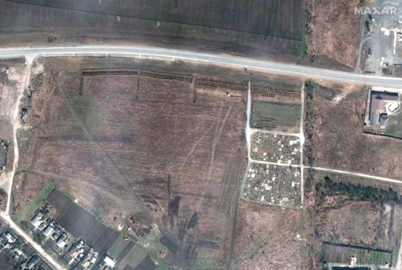
Timed images of apparently murdered civilian bodies lying in the streets of Bucha, Northern Ukraine, have been used to categorically dismiss Russian claims that its forces had left the area by the time the corpses appeared. More recently, images of mass graves outside of the besieged city of Mariupol, where only a small pocket of Ukrainian defenders are left, have been captured.
Comment by David Todd: While Maxar does release certain images for free as a gesture towards public good, the release does give it a secondary benefit of showing just how good Maxar imagery is. It is perhaps a fair reward for Maxar for doing such good work.

